Florida Memory is administered by the Florida Department of State, Division of Library and Information Services, Bureau of Archives and Records Management. The digitized records on Florida Memory come from the collections of the State Archives of Florida and the special collections of the State Library of Florida.

State Archives of Florida
- ArchivesFlorida.com
- State Archives Online Catalog
- ArchivesFlorida.com
- ArchivesFlorida.com
State Library of Florida
Related Sites
19 items found
| Identifier | Title | Type | Subject | Thumbnail | |
|---|---|---|---|---|---|
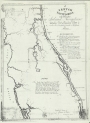
| fmc0044 | East Florida Inland Navigation Sketch, 19th century | Inland navigation--East Florida--Maps, Manuscript. Canals--East Florida--Maps, Manuscript. East Florida--Maps, Manuscript. | /FMP/maps/thumbnails/fmc0044.jpg | ||
| fmc0174 | Map of Apalachicola Bay Florida, 1896 | Florida--Apalachicola Bay--Maps. Nautical charts--Florida--Apalachicola Bay--Maps. | /FMP/maps/thumbnails/fmc0174.jpg | ||
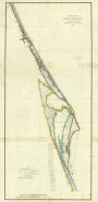
| fmc0080 | Map of East Coast of Florida from Amelia Island to Anastasia Island, 1871 | Nautical charts--Florida. Nautical charts--Florida--Saint Johns River | /FMP/maps/thumbnails/fmc0080.jpg | ||
| fmc0079 | Map of East Coast of Florida, Halifax River to Cape Canaveral (Fla.), 1877 | Nautical charts--Florida--East coast. Nautical charts--Florida--Indian River. Nautical charts--Florida--Banana River. Nautical charts--Florida--Halifax River. | /FMP/maps/thumbnails/fmc0079.jpg | ||
| fmc0095 | Map of Strait of Florida, 1852 | Caribbean Area--Maps. | /FMP/maps/thumbnails/fmc0095.jpg | ||
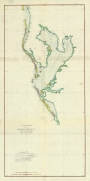
| fmc0082 | Map of Tampa Bay, 1877 | Nautical charts--Florida--Tampa Bay. Nautical charts--Florida--Sarasota Bay. Nautical charts--Florida--Clearwater Harbor. Nautical charts--Florida--Saint Joseph's Harbor. Mexico, Gulf of--Nautical charts. Gulf Coast (Fla.)--Nautical charts. | /FMP/maps/thumbnails/fmc0082.jpg | ||
| fmc0078 | Map of West Coast of Florida, St. Joseph Bay to Mobile Bay, 1877 | Nautical charts--Florida--Cedar Key. Mexico, Gulf of--Nautical charts. Gulf Coast (Fla.)--Nautical charts. | /FMP/maps/thumbnails/fmc0078.jpg | ||
| fmc0043 | Profile on Line of a Proposed Ship Canal, 1880 | Canals--Florida--Maps. | /FMP/maps/thumbnails/fmc0043.jpg | ||
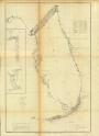
| fmc0049 | Survey Map of East Coast of Florida, 1860 | Coasts--Florida--Maps. Nautical charts--Florida--Gulf Coast. Nautical charts--Florida--Florida Keys. Nautical charts--Florida--Atlantic Coast. Gulf Coast (Fla.)--Maps. Florida --Maps. Atlantic Coast (Fla.)--Maps. Islands--Florida--Maps. | /FMP/maps/thumbnails/fmc0049.jpg | ||
| fmc0075 | U.S Coast Survey, Florida Panhandle, 1855 | Coasts--Gulf States--Maps. Gulf Coast (U.S.)--Maps. | /FMP/maps/thumbnails/fmc0075.jpg |